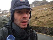
.jpg) around the base of Rhinog Fawr aiming to use the path to its summit if the weather cleared. I stopped again for lunch and tried to dry out some of my gear. I wasn’t trying to make big miles, the experience of being out in a wild place was enough and I took my time eating and resting.
around the base of Rhinog Fawr aiming to use the path to its summit if the weather cleared. I stopped again for lunch and tried to dry out some of my gear. I wasn’t trying to make big miles, the experience of being out in a wild place was enough and I took my time eating and resting.As I headed towards the Roman steps, the weather closed in again. There was no point in trying for the summit, the wind was gusting quite strongly and the cloud base was low. I struck out west, aiming for Lyn Du. At this point, I began to encounter the legendary Rhinogs path network made up of a series of well trodden paths that vanish into nowhere. I could see Lyn Du below me, but despite the path markings on the map, I was wading through thigh deep heather and sliding down if not life threateningly, certainly limb threateningly steep slopes. The ground was full of holes and then just as I thought I was totally lost, I noticed that the heather had been stripped away and pushed all in one direction as if someone else had semi fallen down the slope many times before. Sure enough, a few minutes later, the path reappeared, marked with a distinctive footprint. I followed this path for a short distance, then became totally lost again. The map and the GPS disagreed violently with each other, there were no paths and I had to resort to wandering in vaguely the right direction until I discovered that what was vaguely the right direction suddenly became exactly the right direction and I was following a well trodden path marked by the man with the distinctive print. This pattern repeated itself the entire afternoon through thick bogs, lethal overgrown boulder fields, down semi cliffs and over ancient barbed wire fences. The membrane in my boots had given up hours ago and I could see the man with the distinctive print going through everything hours (days?) before me. I knew I wanted to camp up by Llyn Twr-glas but the lakes were stubbornly refusing to appear. I checked my position against the farm over the valley and had no idea why I couldn’t see them. Finally, checking my GPS, I realised that I was a good 100m below where I wanted to be. With the tops concealed in the mist, I had little idea of where I needed to be- my map reading skills obviously need a little more polishing!
Up I went. It was hard work and I had no visual idea of where I was aiming for- I just watched the little numbers climb steadily upwards. In the back of my mind I had a feeling that this wasn’t the best idea I had ever had but stuck to my plan. I had been expecting to see the lakes all afternoon and wanted to satisfy myself that they really existed! I reached the top just as the worst rain of the entire trip blew in. The storm battered away at me- I could barely see two feet in front of me and the lakes were reduced to a narrow band of water at my feet. I had a notion that there was a slightly more sheltered area at one end of Llyn Twr-glas but at that moment I realised I had lost my map. I hadn’t checked it since I had started climbing and began to get the distinct feeling that the Gods were laughing at me. Luckily I was able to retrace my steps and found it fairly close by. The storm was in no way abating and I was beginning to feel pretty sorry for myself. I didn’t want a repeat of the other night, didn’t fancy erecting the tent in the rain and was fairly exhausted. I made my way towards Llyn Pryfed hoping to find some shelter where the rocks pinched in towards each other but it just wasn’t happening. I gave up and began to use a wall as a handrail back down towards the valley. Even this became another dance with lady fracture as the wall led me over a huge boulder field with steep drops and concealed thigh deep holes. Again, I obviously wasn’t the only idiot to have chosen this route as there were definite signs of previous idiots.
.jpg) Typically, the valley was bathed in sunshine. I was encountering another problem now- I was getting ever closer to civilisation and there weren’t many obvious camping spots. The valley was also pretty exposed if the wind kicked up again and I wasn’t keen on holding the tent down all night. I found a clump of trees on one side of a field but there really wasn’t enough room between the braches to pitch the tent. On top of that, it was too sheltered and quickly became a bit midgy. I wandered further, slightly worried and feeling a bit beaten up after the hard work of the day’s walking. Finally after a lot of backwards and forwards along the route of a river I found a fairly lump free spot. Here the ability of the Gatewood cape to be fairly easy about misshapen pitches came into it’s own. I used a section of my compass lanyard and a mitten hook to repair the broken hook on the cape and settled down to empty the water from my boots and the whisky from my hip flask.
Typically, the valley was bathed in sunshine. I was encountering another problem now- I was getting ever closer to civilisation and there weren’t many obvious camping spots. The valley was also pretty exposed if the wind kicked up again and I wasn’t keen on holding the tent down all night. I found a clump of trees on one side of a field but there really wasn’t enough room between the braches to pitch the tent. On top of that, it was too sheltered and quickly became a bit midgy. I wandered further, slightly worried and feeling a bit beaten up after the hard work of the day’s walking. Finally after a lot of backwards and forwards along the route of a river I found a fairly lump free spot. Here the ability of the Gatewood cape to be fairly easy about misshapen pitches came into it’s own. I used a section of my compass lanyard and a mitten hook to repair the broken hook on the cape and settled down to empty the water from my boots and the whisky from my hip flask..jpg) It was actually a very good pitch. The weather held and in fact, the next day was glorious sun. I wandered down into Trawsfynyedd enjoying the easy walking and feeling a bit disoriented by having to actually talk to people. It was only on the bus back to Barmouth that I realised how bad I smelt. It was my boots- they had a distinct aroma of tramp to them. I bought some flip flops in a tacky seaside shop, paddled in the sea and scrubbed my feet with sand. There’s not that much to do in Barmouth so I decided to catch an earlier train back. I picked up a couple of bottles of beer (Including a welsh lager?) bought myself a new book from a charity shop and settled down for the long journey back. The Rhinogs certainly lived up to their reputation for being hard work but it had been a good trip. The ability of my gear to work in British conditions had been proved to my satisfaction- the failure of the hook on the cape was easily repaired and all my down gear had remained effective despite the wet weather. The use of quick drying clothes meant that I was comfortable and warm and I certainly felt the
It was actually a very good pitch. The weather held and in fact, the next day was glorious sun. I wandered down into Trawsfynyedd enjoying the easy walking and feeling a bit disoriented by having to actually talk to people. It was only on the bus back to Barmouth that I realised how bad I smelt. It was my boots- they had a distinct aroma of tramp to them. I bought some flip flops in a tacky seaside shop, paddled in the sea and scrubbed my feet with sand. There’s not that much to do in Barmouth so I decided to catch an earlier train back. I picked up a couple of bottles of beer (Including a welsh lager?) bought myself a new book from a charity shop and settled down for the long journey back. The Rhinogs certainly lived up to their reputation for being hard work but it had been a good trip. The ability of my gear to work in British conditions had been proved to my satisfaction- the failure of the hook on the cape was easily repaired and all my down gear had remained effective despite the wet weather. The use of quick drying clothes meant that I was comfortable and warm and I certainly felt the .jpg) benefit of carrying such a light load.
benefit of carrying such a light load.

3 comments:
Excellent blog. Hope you keep posting.
Sounds like a long day! Damn that low cloud but is just a reminder that we could all do with brushing up on our navigation skills!
Nice to see someone doing a bit of video for a change.
I've always been 'pretty much ok' with my navigation, which is probably not good enough. I'm hoping to do a fair bit more with video- it takes a lot less time than writing!
Post a Comment